AERIAL SURVEYING WITH LAND SURVEYS
 Facebook
 Twitter
 Linkedin
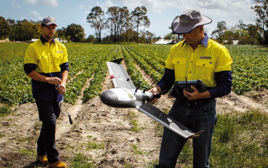
Capturing and processing aerial imagery to generate detailed and useful survey data is nothing new – this method of survey has existed for decades.
What is new, however, is the relatively inexpensive and accessible technology of Unmanned Aerial Vehicles (UAVs). These often small UAVs, or drones as they are commonly referred to, can be operated remotely and autonomously to cover specific areas of interest quickly and easily.
What is meant by UAV and UAS?
The term UAV simply refers to an Unmanned Aerial Vehicle. It is the term used to describe the vehicle operated to capture data from the air. The key component being that the UAV is being operated by someone remotely from the ground and in most cases is flying itself autonomously to capture data. The term UAS refers to an Unmanned Aerial System which consists of the vehicle being used, the operator who is controlling the vehicle and the automated flight systems and software being used to control the vehicle. There are a range of different terms that are used in place of UAV, some are; RPAS, UAS, RPA, RPAS and Drone.
At Land Surveys, we operate a range of fixed wing and multirotor platforms that are suited to a variety of applications. We ensure our UAS is consist of reliable and safe Unmanned Aerial Vehicles which have industry leading software and autonomous flight capabilities and most importantly, are only operated by certified and experienced personnel.
This ensures that no matter the size or scope of a project, Land Surveys has the equipment and personnel to execute.
The benefits of surveying with UAVs:
A rapidly increasing number of companies are realising the benefits of using UAVs to undertake a wide variety of survey and spatial applications. The relatively small and easy to operate aerial platforms can be transported easily and used to capture imagery of small specific areas that would be uneconomical or impractical to cover with a traditional manned aerial survey. These aerial images are then quickly processed and transformed into meaningful outputs such as high resolution, orthorectified images and accurate 3D surfaces models. Instantly, these outputs can be used for a variety of applications including;
– Visual analysis of a project and its assets
– Monitoring progress of earthworks and construction projects
– Accurate 3D and 2D measurements like stockpile volumes and haul road grades
– Environmental monitoring
– Pit wall mapping and monitoring
– Tailings storage facility mapping
– Topographic situation for drainage and flood modelling.
All of this information is directly compatible with survey and engineering software providing a complete and visually detailed data set to integrate into a project’s workflow.
With a proven track record of safe and reliable UAV operation, our clients’ praise our unmatched level of expertise and ability to go above and beyond to deliver professional surveying services. For more information on this, or any of our other services get in touch today.