Image Scanning
What is image scanning?
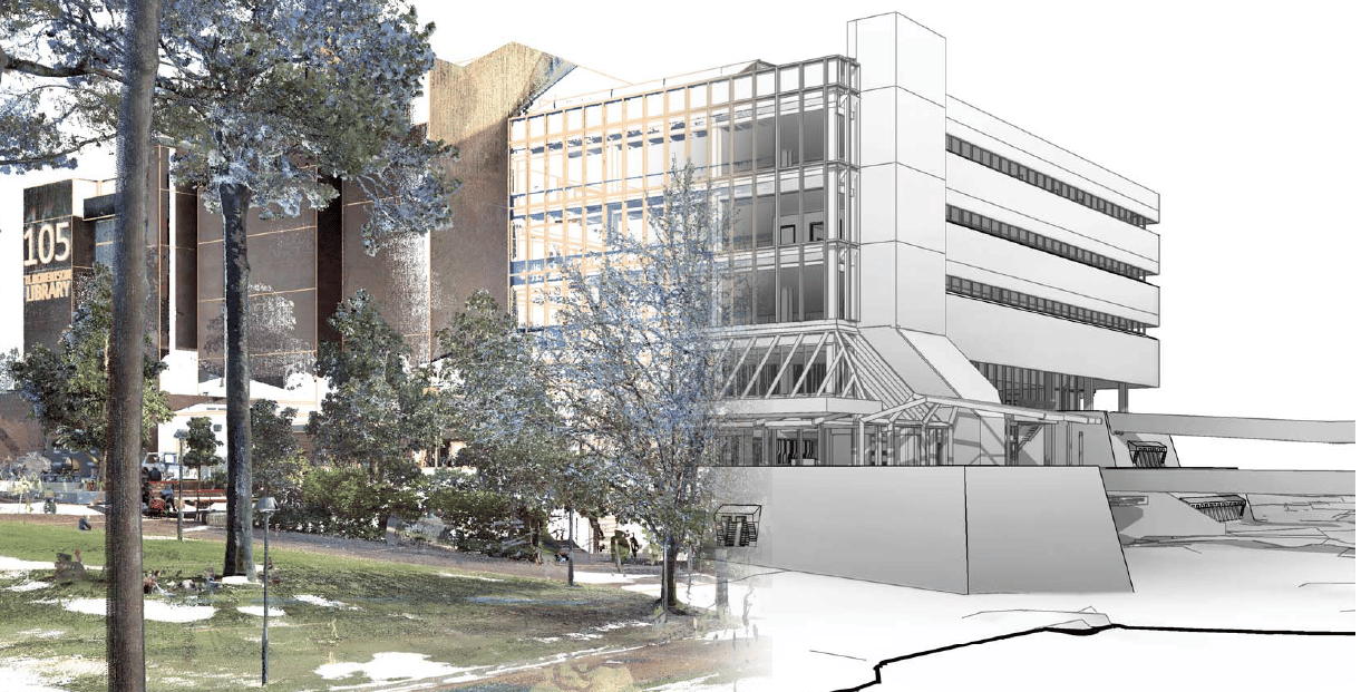
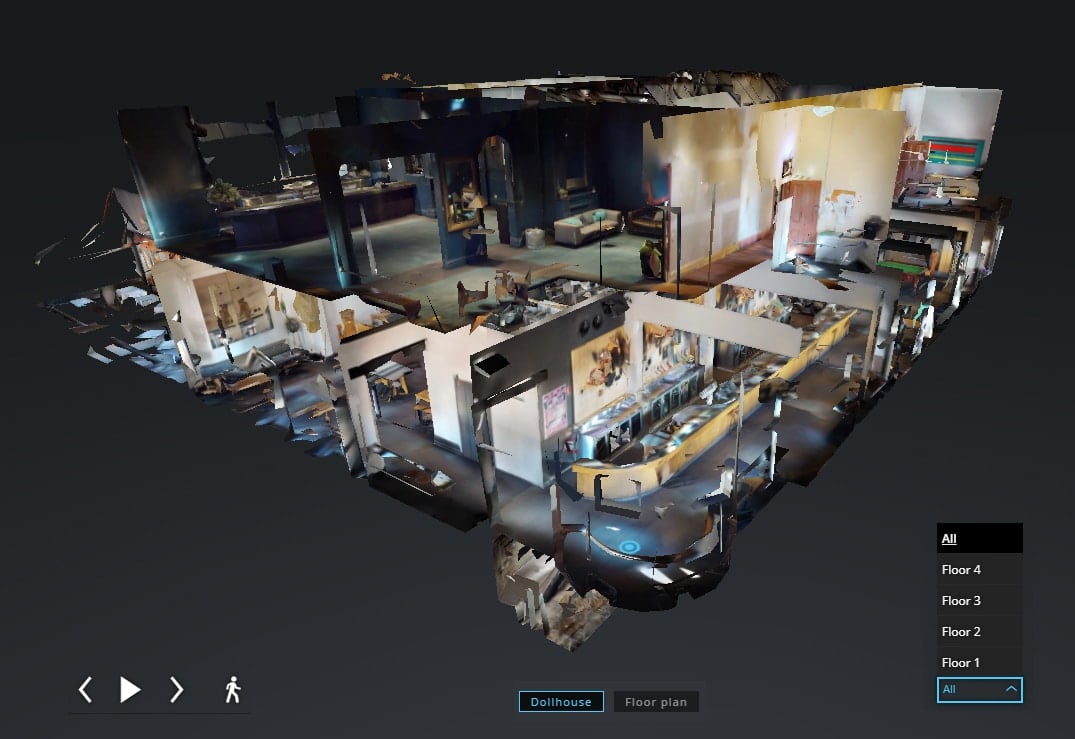
Imaging-based scanning systems provide rapid, safe, and non-invasive data acquisition to create high context geospatial data sets. They utilise overlapping, high-definition imagery to create 3D meshes and point clouds via photogrammetric processing techniques.
The resultant data sets can be further analysed to create a variety of different 3D model deliverables depending on the requisite application, and the level of detail and visualisation required.
How image scanning works
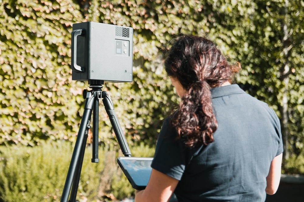
Image scanning uses tens to hundreds of overlapping high resolution digital images to create the digital replica. When we use digital images, either from a UAV, vehicle, or handheld camera, we use photogrammetric techniques to combine the overlapping images to create a 3D mesh of the object or building.
Utilising image scanning
Advantages of imaging-based systems include the capture speed, quality, and consistency of the resulting 3D mesh and orthophotos (providing accurate representation of the earth’s surface) to create a digital twin of the as-built environment.
The benefits of using image scanning
Imaging systems are typically used to collect data over larger areas at a faster capture rate than is afforded by laser-scanning systems. This allows imaging-based systems to be used for many applications including:
- scan to Building Information Modelling (BIM) – scanning existing assets to create a digital twin or an as-built 3D model;
- architectural and heritage surveys;
- dilapidation, condition assessment and inspection;
- clash detection and conformance;
- topographic and feature surveys; and
- volumetric surveys.
Land Surveys can help solve challenges with image scanning
Image scanning is ideal for applications that require a lower level of detail over a large area and in a short timeframe. Due to their superior image quality deliverable, image scanners are also well-suited to applications in which challenges of visible change detection area are critical, for example changes in colour, texture and surface defects.
Why choose Land Surveys for your image scanning requirements?
Land Surveys uses a variety of image-scanning systems and platforms depending on the size and level of detail of the asset or environment to be scanned, and accessibility within that environment. While all image scanning systems utilise the principles of photogrammetry to create 3D mesh and point clouds, different systems have different capabilities and range, therefore selecting – in consultation with Land Surveys – the appropriate system for the required output is critical.