Utility Mapping – Underground Services


What is subsurface utility information?
Subsurface utility information (best known as SUI) is, as the name implies, created from locating and mapping of underground utilities. The types of information collected includes the location and depth of underground pipes, cables, and inspection pits, and cambers associated with power, communications, water, storm-water drainage, sewerage, gas and signalling utilities.
How utility locating and mapping services work
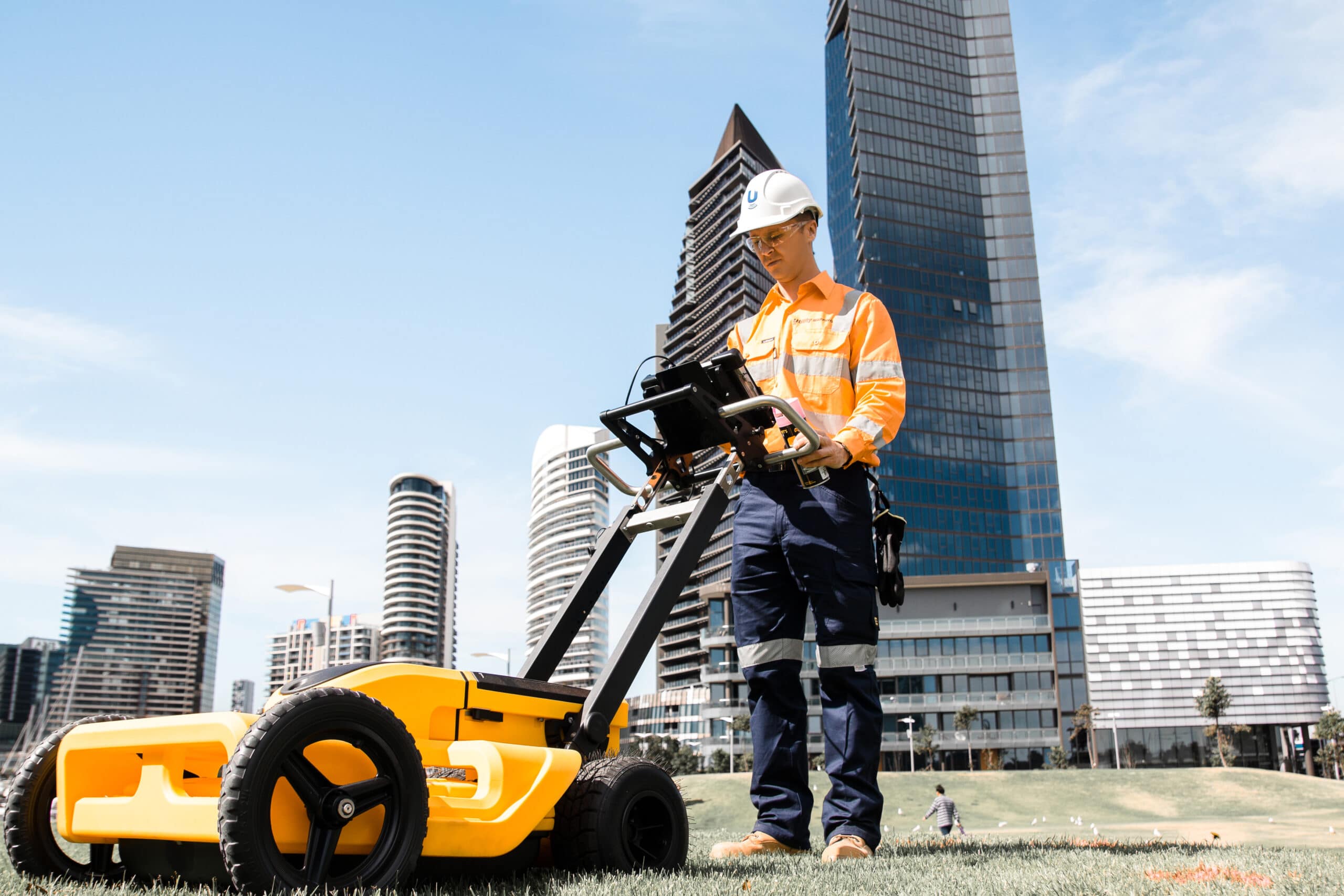
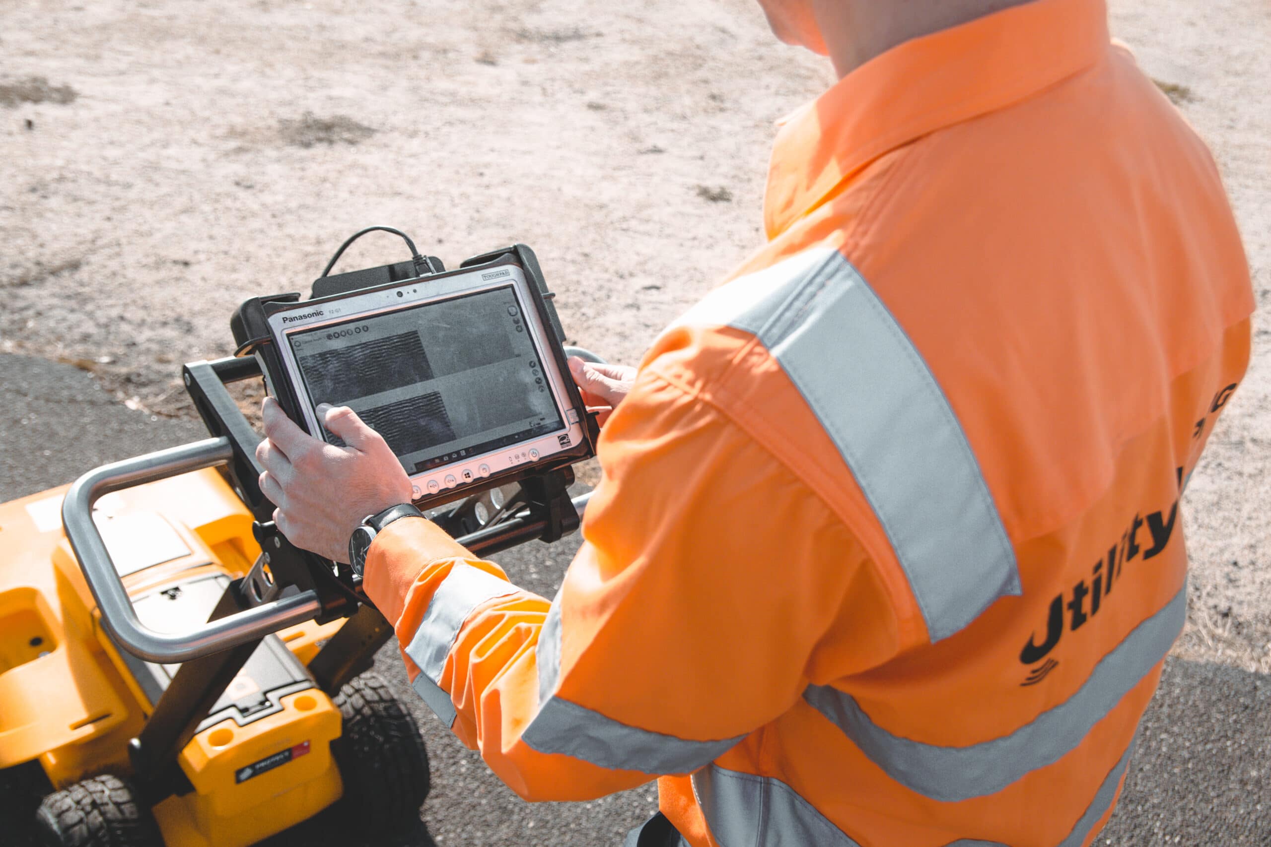
Land Surveys utility locating, and mapping services utilise a variety of geophysical, electromagnetic, and high-frequency induction techniques and field practices to locate, map, and validate underground utilities to create 3D spatial models and generate their associated utility information.
The mapping process includes lifting all pit covers and manholes to collect and detail information such as pipe and chamber sizes, direction of flow, conduit sizes, construction materials, configuration, and utility type. Land Surveys then records all these findings on manhole and pit report cards. Once utilities have been located, we accurately record the position and depth with high-accuracy Global Navigation Satellite System (GNSS) or total station survey techniques. We also provide feature and level surveys as required, and we can link into existing survey control from an existing feature survey.
Importantly, all of Land Surveys utility location and mapping surveys are conducted to, and delivered in accordance with, Australian Standard AS 5488.1-2019 Subsurface Utility Information (SUI).
Utilising Utility Locating and Mapping
One of the greatest risks to any development or construction project are ‘strikes’ or incursions and subsequent, serious damage to underground utilities and the impact this can have on a project, the community and utility service providers.
The benefits of SUI and numerous but primarily include the following elements:
- the utility information is critical for planning and determining the feasibility of any project;
- utility locating and mapping services validate existing utility locations and data from existing asset owner plans and search for unknown utilities, using a range of geophysical techniques;
- designers need to reply on spatially accurate, detailed utility information to enable efficient and cost-effective design
- effective management of the locating, validation and protection of underground utilities with an integrated ground disturbance permit system significantly reduces the risk of injury and project delays; and
- management of existing and new as-built survey data through a single platform provides a single source point-of-truth source for all spatial data.
Applications of utility mapping and locating services include concept design, detailed design, utility relocation and underground storage tanks (USTs).
The benefits of using utility locating and mapping services
Utility surveys provide 2D and 3D identification and confirmation of known and unknown utilities within the project area. This as-built spatial data can be combined with other above–ground, as-built and/or design information to provide insights as to how structures and assets interact with each other and provide a visual reference for identifying potential risks.
How can Land Surveys solve challenges with subsurface utility information?
Once we have delivered our utility survey data, our geospatial and digital engineering specialists can work with clients in the conflict analysis stage to plan a potholing campaign where existing utilities clash with a proposed design.
Our underground utility locating, and mapping solutions services can add value to your project by:
- creation of 2D and 3D datasets suitable for building information modelling (BIM), geographic information system (GIS) mapping and engineering design;
- mitigating potential conflicts in design to avoid costly construction delays;
- providing a staged approach for conduct conflict analysis of utilities clashing with design; and
- providing a spatial single point-of-truth database that can be updated throughout the project or asset lifecycle, and that can be used for ground disturbance permit (GDP) management solutions.
Why choose Land Surveys for your utility locating and mapping requirements?
We are committed to delivering innovative utility mapping solutions for the civil and design, environmental, geotechnical, utilities, infrastructure, and facilities management sectors. This is our acknowledged stock in trade.
Contact us
For more information on how we can accurately locate and survey utilities for your design or construction project, contact one of our offices in Melbourne, Sydney, Brisbane, Adelaide, or Perth today. Get in touch below with any queries you may have about how we can provide you with the right solution 1300 526 378.