Geospatial Data Management Service
What is Digital Engineering?
Digital engineering captures, integrates and aligns discrete digital systems such as Building Information Modelling (BIM), Geographic Information Systems (GIS), Facility Management Engineering (FME) and other related data systems. In doing so it drives and optimises the design, engineering, construction, operation and maintenance of assets. It provides for the aggregation of computable digital data, allows for collaboration and manipulation of such data to create insights that drive better outcomes across all phases of an asset’s lifecycle.
What is Data Management as a Service?
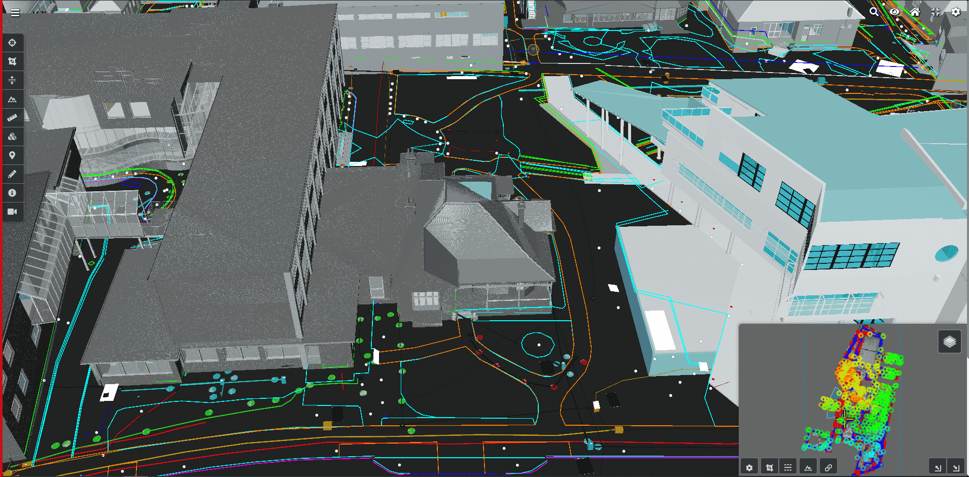
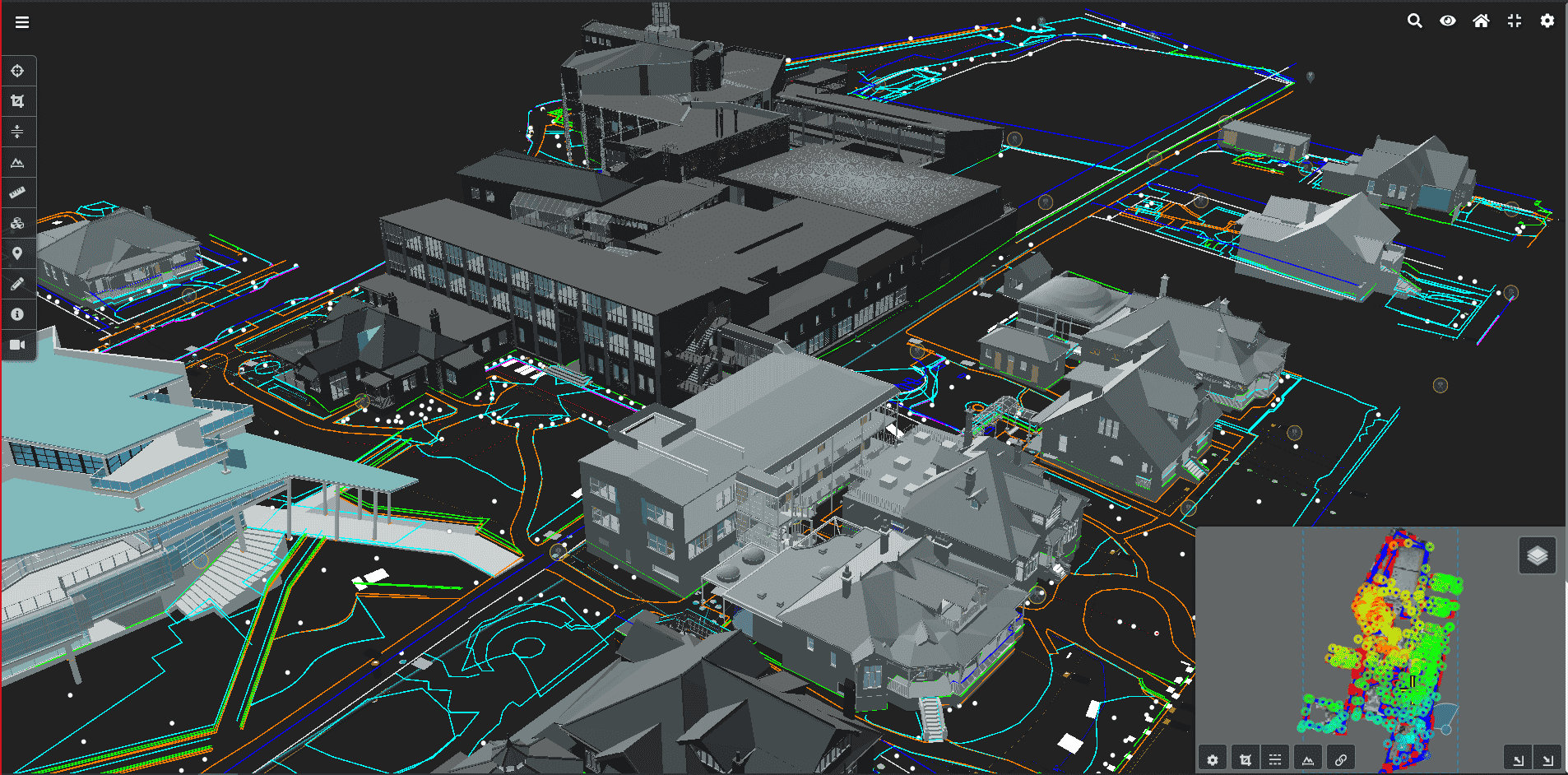
A core component of any digital engineering ecosystem is the collection and management of geospatial (GIS) data sets to create the highest level of value. The easiest way to aggregate, manage, visualise, and collaborate with these data sets is via a secure cloud-based Data Management as a Service (DMaaS) solution. This geospatial database provides unlimited storage capability that allows users to access and visualise their GIS data.
How Data Management as a Service works
Geospatial data sets come in an array of sizes, types, and representations. Typically, they are large and comprise millions of points (especially in the case of point clouds) and cannot be easily loaded or utilised in engineering-specific applications.
Typically, these engineering-specific software systems can only work with smaller subsets of the data, or data of a particular type. DMaaS provides the means to manage and visualise large geospatial data sets within a secure, networked ecosystem. Users can then access and extract the data sets they need as and when required.
Utilising Data Management as a Service
There are numerous different DMaaS services and solutions available depending on a client’s needs and the class of geospatial data to be managed. Data is uploaded and made accessible via a secure web portal for nominated users. The ability to upload geospatial data sets of different types and sizes includes processed data sets from industry standard reality capture solutions including unmanned aerial vehicles (UAV), terrestrial laser scanning, mobile laser scanning and image scanners (among others on demand).
Benefits of using Data Management as a Service
- Aggregation of geospatial data sets into a single, secure and readily accessible storage platform.
- Creation of a single point of truth (SSOT) for related data sets within a common environment.
- Easy access to geospatial data sets and 3D models with web browsers, removing the need for local data storage and specific software installed on your computer system.
Solve challenges with Land Surveys’ Data Management as a Service
DMaaS solutions provide clients with a secure portal to store and manage large and complex geospatial data sets. They also provide collaboration with multiple parties from a single point of truth (SSOT), thereby ensure consistency in the data utilised by all cooperating parties.
Choose Land Surveys for Data Management as a Service
Land Surveys has an extensive range of experience with large and complex data sets for a range of different projects and asset types across their lifecycles – from design, construction, management and maintenance to closure.
We understand the value and, critically, costs to create fit-for-purpose geospatial data. We also respect the importance of ensuring that data is not only secure but readily accessible to those that need it when they need it.