Geospatial Data Analytics
What are Geospatial Data Analytics (GDA)?
For data to be meaningful it needs to be manipulated and analysed to extract insights that can be exploited. As the adage runs, knowledge is information, and information (in this case data) is king. So, information is needed by key stakeholders to support their vital decision-making processes.
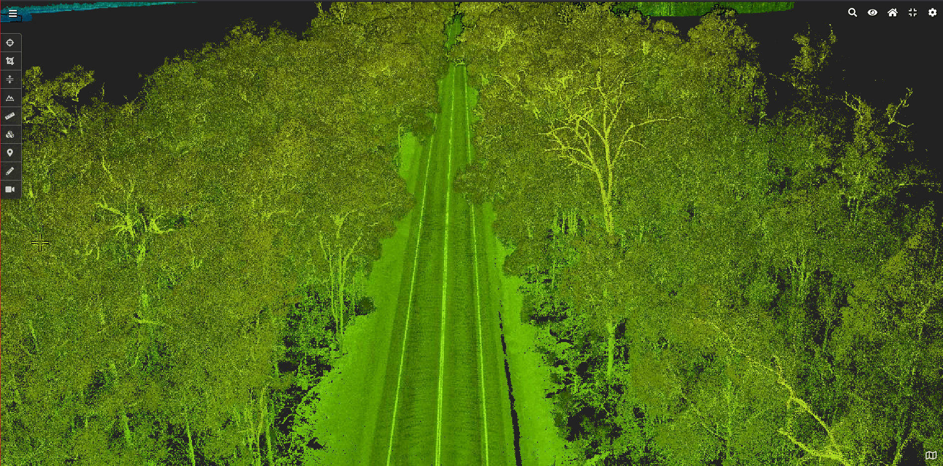
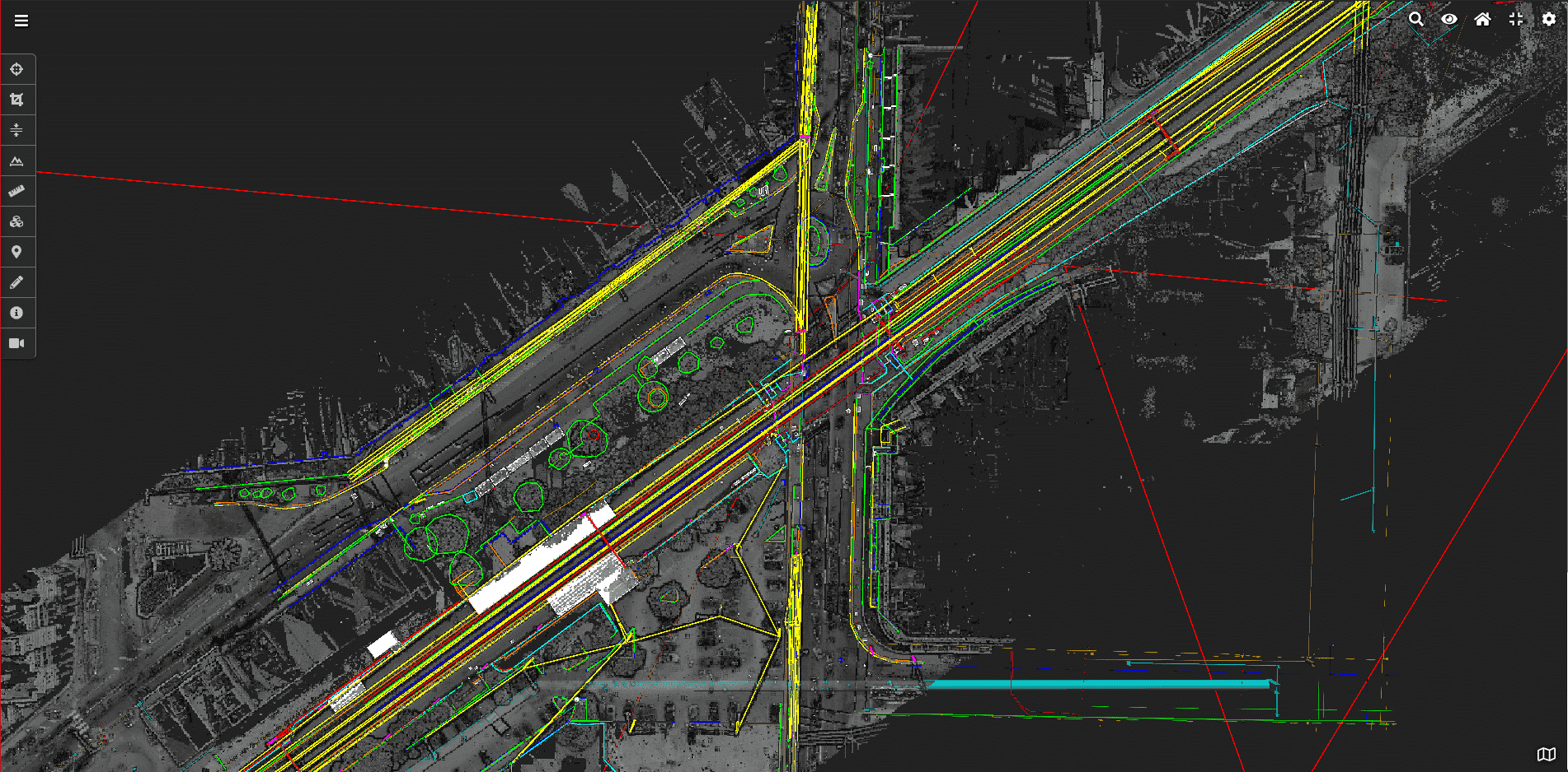
Geospatial Data Analytics (GDA) is all about connecting the information and insights that stakeholders need and matching this with fit-for-purpose geospatial data and the analytical tools that will be used to create information. Information can be everything from natural and built-form features extracted from a point cloud (or 3D-textured mesh) or analysis between two different geospatial data sets at different points in time to detail clashes or change over that timeframe. Data analytics can be used to identify changes that are either geometrical or visual in nature, or both.
The GDA process starts with understanding two pivotal questions:
- what information is needed based on the decisions to be made?
- based on the information required, what type of geospatial data and subsequent data analytics are required to create the information?
How Geospatial Data Analytics Works
There is a broad range of different manual, semi-automated and automated tools to use in undertaking data analytics on geospatial data sets. In the basic form, manual and semi-automated processes can be used to analyse and extract visible natural and built-form features from a point cloud or 3D mesh. At the other end of the scale, machine learning (ML) algorithms can be utilised to automatically identify specific features from geospatial data sets based on their geometrical properties, metadata, or from the colour and shape revealed via 2D imagery.
Utilising Geospatial Data Analytics
Data analytical tools and processes are used to identify, extract, and create additional layers of information at a given point in time that, when overlaid on the original digital twin, show, or identify key features or changes. The resultant output from the data analytics can then be customised for reporting purposes, for other 3D-engineering applications, or third-party data management systems.
The next step in data analytics is using the output from the automated ML processes to ‘seed’ artificial intelligence (AI) algorithms to automatically make decisions and take actions on the information that has been created.
Benefits of Geospatial Data Analytics
Data analytics are driven by extracting multiple layers of information from a single geospatial data set. Different insights and information are needed by different stakeholders based on the decisions they need to make. Multiple different insights and benefits can be derived by working with a single point in time data set or using data analytics to identify changes or clashes between data sets from two (or more) points in time.
With modern-day advances in computing power and the speed and quality of reality capture systems, the greatest benefits for data analytics are the ability to identify change between data sets over time. It is the ability to identify and qualify theses changes in a timely manner that provides the highest level of value.
The benefits of data analytics include the following factors:
- extracting greater more insights and information from geospatial data sets
- utilising the latest ML and AI algorithms for fast and efficient analysis of large data sets to identify key features or extract key information
- data-analytical tools and processes can be created for a particular task to identify specific features or occurrences
- Ability to visualise change over time to provide understand and context
Solve Challenges with Land Surveys’ Geospatial Data Analytics
Active utilisation of data analytics focuses on finding solutions for decision makers, including:
- the extraction of natural and built-form features from geospatial data sets
- condition assessment, identification and classification – visual
- change(s) over time – geometric and visual
- clash detection – as-built versus design
- volume calculations and analysis
Choose Land Surveys for Geospatial Data Analytics
Outcomes from geospatial analytics are driven by data. Land Surveys has one of the widest range of reality capture tools and techniques to create fit-for-purpose data sets required for data analytics. By taking the time to understand why information is required – and how it will be used – Land Surveys matches the appropriate and applicable data and data-analytics tools to achieve exacting, workable outcomes.